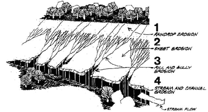
Watershed SurveyDuring summer 2011, the Crystal Lake Conservancy equipped volunteers with watershed and property maps, clip boards, pencils and data collection forms. The volunteers conducted comprehensive watershed surveys for all properties in the Crystal Lake watershed, noting storm water drainage, vegetation, property slopes, erosion, land use and any sources of pesticide or herbicide use. The purpose of the survey was to have a better understanding of the activity in the watershed area that could correspond to water quality surrounding
|
 |
|
each of the 8 outfalls. Data was analyzed to see if there was a correlation between that area of the watershed and any potential problems in Crystal Lake. Survey findings can be found in the presentation at the CLC Annual Forum in October 211.
The survey encompassed 34 streets in and around the area of Crystal Lake. These streets include: Albion Place Hyde St Norman Rd Albion St. Kenmore St Norwood Ave Allerton Rd Lake Ave. Pinecrest Rd Beacon St Lakewood Rd Rogers St Berwick Rd Laurel St Rotherwood Centre St Moreland Ave Saxon Rd Crescent Ave Newbury St. Saxon Terr Crystal St Newbury Terr Trowbridge St |
|
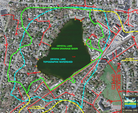
The diagram below shows the storm drains in the Crystal Lake Watershed area and how they enter into the Lake via 8 outfalls.